Routes
Overview
OsmAnd has many powerful features for displaying different routes on the map. By default these routes are part of vector maps (OpenStreetMap data), however similar functionality is provided by tracks which could be created with Plan a Route, imported as GPX tracks, recorded with the Trip Recording plugin.
Type of Routes
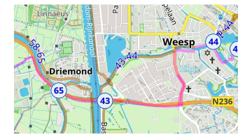
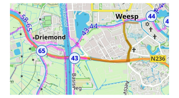
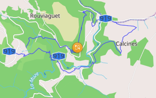
Routes represent different outdoor activities using data from OpenStreetMap. Tapping the shield icon with a route number or route flag on the map will open a context menu which provides additional information about the route and allows to use it as part of navigation.
You can configure filtering of some route types in Configure Map menu.
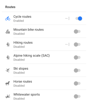
Cycle routes
Cycle routes are present as three types: local (lcn), regional (rcn), national (ncn), international (icn). Also cycle routes could be part of Node networks. You can choose how to assign color to the route segments:
Route.
Node networks.
You can find more information in the Map Legend article.
Mountain bike routes
MTB routes have specific mapping in OpenStreetMap and could be selected separately from cycling routes.
MTB scale. Shows trails according to MTB scale. You can find more information in the Map Legend article.
IMBA. Show MTB trails accorgind International Mountain Bicycling Association MTB IMBA. More information in the article Map legend.

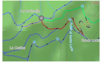
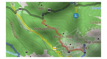
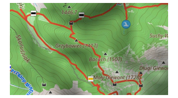
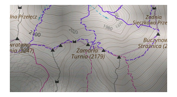
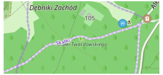
Hiking / Walking routes
Hinking routes are present as three types: local (lwn), regional (rwn), national (nwn), international (iwn). Also walking routes could be part of Node networks. OsmAnd doesn't separate walking and hiking routes and combines them into 1 group. You can choose how to assign color to the route segments:
OSMC. Colors routes according to their individual local color (if available in OpenStreetMap) and the tourist shield symbol.
Network affiliation. Colors by network affiliation.
Node networks. Colors routes according to the type of node network (international, regional, or local).
Hiking Trails Difficulty Grade
Some road segments could be part of many routes but they could be individually colored to represent difficulty for the segment in mountainous areas. Currently OsmAnd supports Italian and Swiss classifications, each of them has a specific list of equipment requirements to access this segment.
Ski routes
Ski routes are a specific group of routes in OpenStreetMap. Typically these routes could be used with Winter and Ski map style with all visible Pistes.
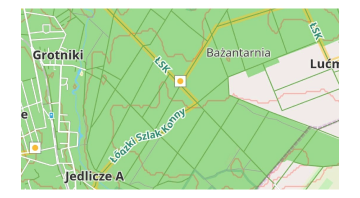
Horse routes
Horse routes are displayed as color-indicated routes with symbols for horseback riding.
Whitewater sports
Whitewater routes are shown together with access icons, danger zones for whitewater tourism.
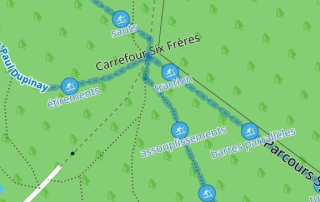
Running routes
Running routes in OpenStreetMap are used for named, numbered, or otherwise marked running routes used primarily for athletics.
Fitness trails
A fitness trail is a trail or path equipped with obstacles or stations along its length to exercise the human body for the purpose of improving health.
Travel routes
Travel routes is part of custom files - Travelbook (.travel.obf). These travelbooks could be generated from user routes or could be part of extra Plugins.
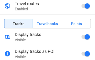
You can configure to display specific Travelbooks or specific type of Tracks or display tracks as Points or display Point groups (for example for Wikivoyage travelbooks). Read more information about Travel guides.
Display Routes on the Map
- Android
- iOS
Menu → Configure map → Routes
Menu → Configure map → Routes
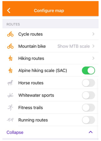
- To display the required routes on the map, enable them in the Routes list of the Configure Map menu.
- OsmAnd can highlight routes present on OpenStreetMap. They can be selected by tapping the symbol on the route, and if the visible set of routes is configured correctly, you can follow the color and icons.
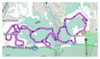
- You can create a track on top of the routes using the Plan a Route tool.
Route Info and Elevation
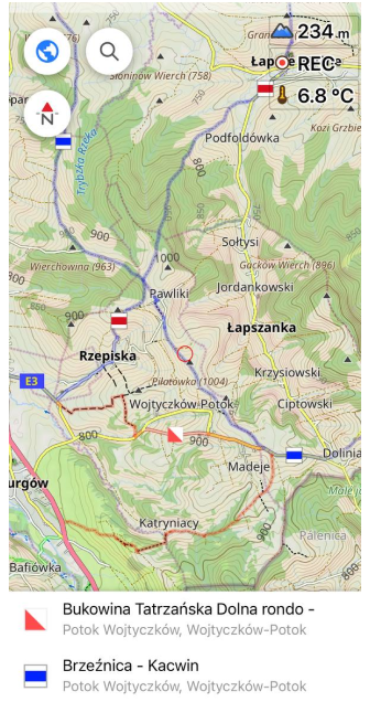
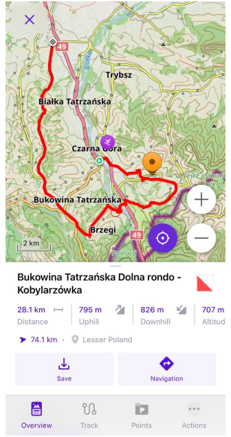
To get full route information and elevation data, tap the route icon (shield) on the map. If you have already used the Download button in the Track context menu, tap the line of the required route on the map.
- Android
- iOS
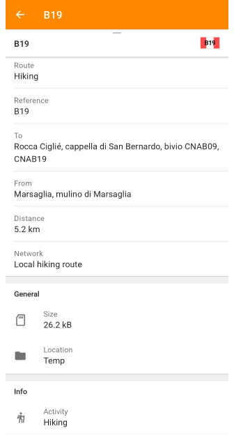
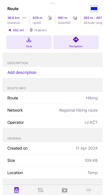
Following information will be visible in context menu:
- Route info: Route name, OSM link (OSM Editing plugin required), Type, Description, Distance, Direction, Ascent/Descent, Altitude range, Network, Operator, State, Color, Roundtrip, Start/End points, and more.
- General: Size, Location, Created on.
- Additional Info: Type of activity.
- Elevation info
- Analyze Track on Map
Save as a Track
- Android
- iOS
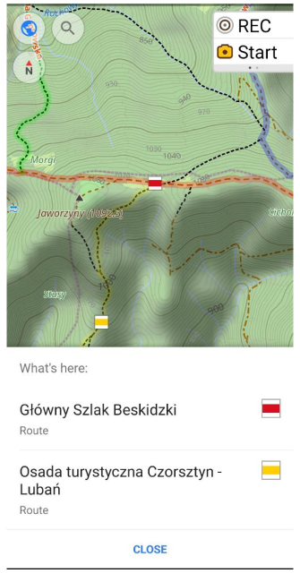
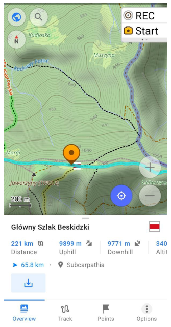
Hiking, Cycle, Travel, and other routes are available for selection on the map, and marked with OSMC symbols. If you tap a route symbol, a list of the routes nearest to it is offered. Selecting one of them opens the Track context menu of the route.
To save the route as a GPX file, tap the Save (Download) button under Info panel. This will open the Quick actions button panel where you will have access to track actions such as changing Appearance, Navigation, or editing Plan a route.
Quick Actions
You can configure to switch on and off routes via Quick action widget.
Related Articles
- Map Context menu
- Configure Map
- Tracks
- Tracks Context menu
- Public transport
- Navigation route line appearance
This article was last updated in August 2024