Tracks
Overview
OsmAnd has many powerful features to display various routes on the map. Routes could be built as part of Navigation, created via Plan Route, imported as GPX tracks, recorded via Trip Recording plugin or browsed and selected from OpenStreetMap data.
Types of Tracks
OsmAnd can display several different type of routes
Tracks (GPX) - recorded or planned trip saved in GPX-format. This kind of route could be imported from the external source, created in the application or recorded by user. GPX could contain one of 3 different types of data or all of them:
- Track as a line (Geometry)- file has
<trkpt>points array, each point has location and optionally time, speed, altitude and other attributes. These tracks are displayed on the map as solid lines. - Track as a route (Route)- file has
<rtept>points array, each point described as an intermediate point of the route. It depends on how points within a route should be connected either as small route segments or via straight line. These tracks are displayed on the map as dashed lines. - Waypoints (Points)- file has
<wpt>points with attributes. Waypoints are displayed as circular points on the map. You could click on them to get additional information.
OsmAnd could create tracks with 1-3 combinations. Plan Route creates track with Geometry and Route, if you save as Simplified Track only Geometry will be kept. Recording track creates only Geometry but it's also possible to add Points via Context menu to it.
Display Tracks on the Map
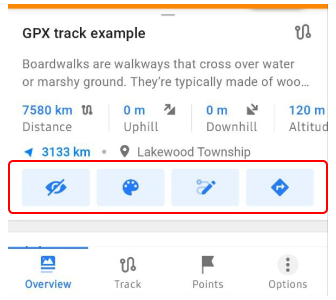
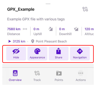
You can choose which tracks to show on the map and which to hide in the My Places menu, the Configure map menu, and in the Track Context menu.
Configure Map
Configure map allows you to quickly select all recently visible tracks, so you can easily switch on/off visibility for collection of tracks. Sorting of tracks is the same as configured in My Places - Tracks. By long tap on the track item, you can access Track menu.Also in this menu you can change appearance for multiple selected tracks.
- Android
- iOS
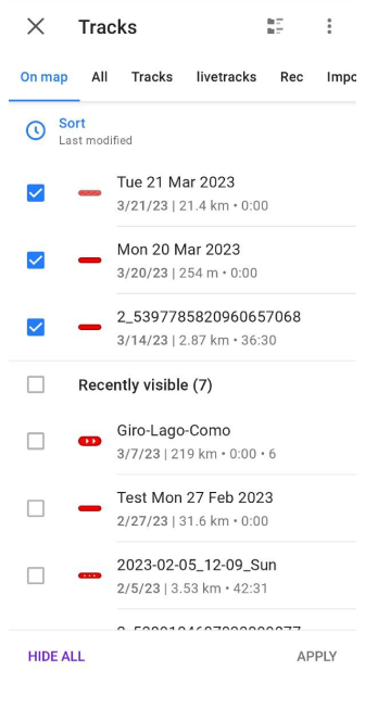
Menu → Configure map → Show → Tracks
Menu → Configure map → Tracks
My Places
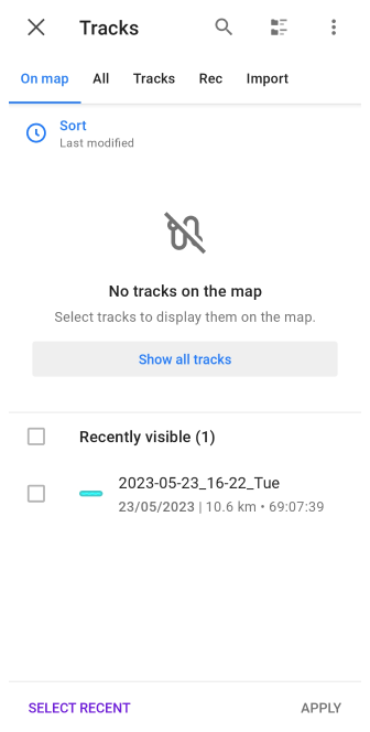
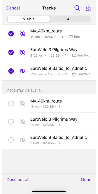
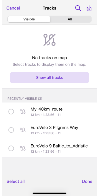
In My places - Tracks to show track on the map, you need to: Android - tap the three-dot menu in the field with the required track, iOS - long tap the required track in the list.
- Android
- iOS
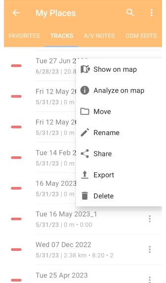
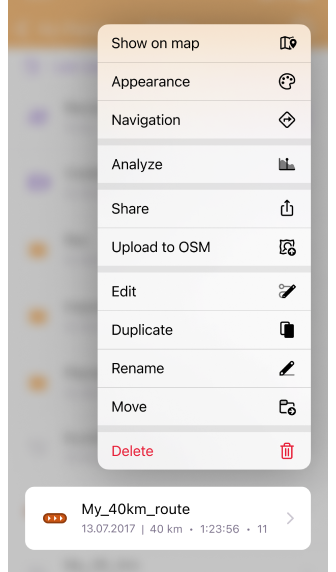
Track Context Menu
If you selected track on the map or open Track context menu after track being recorded or imported, you can also use Show / hide buttons allow to anable or disable displaying of a track on the map.
- Android
- iOS
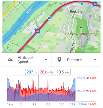
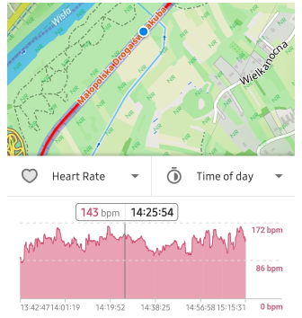
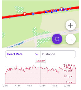
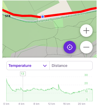
Analyze Track on Map
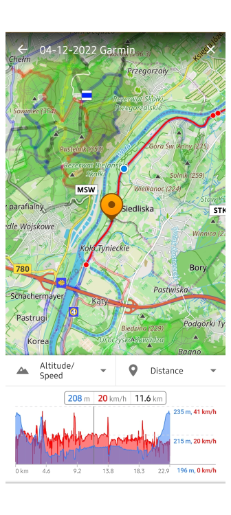
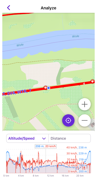
This tool allows you to view track information using graphs and maps.
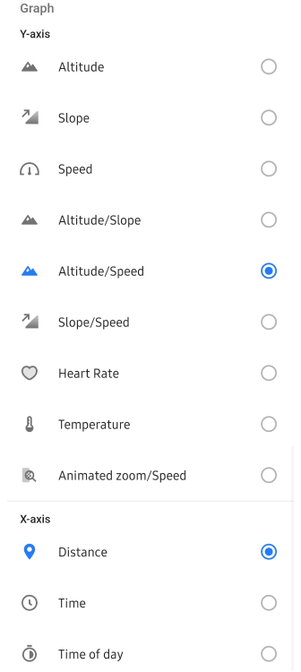
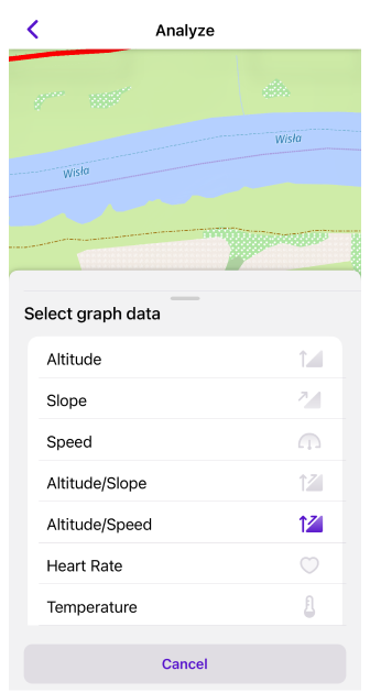
- Graph data (Y-axis): Altitude, Slope, Speed, External sensors data, or a combination of the two (if data is available on the track).
- Graph dimension (X-axis): Distance, Time, Time of day.
- Tap/Slide. Tap the Graph to display information about the track point and moving it along the Graph highlights the location of the point on the map and displays information about it in the bar.
- Scale. Scale the Graph with a two-fingers gesture.
Follow My Location
Tap the My Location buttonto have the map view and graph synchronized with your location. In this case, graph scale will remain the same and the bar information will be fixed to 1/4 to the left. As you move, the graph will slide from left to right, displaying information ahead of your track. This feature is useful for hiking and cycling while navigating, although no other widgets are displayed on this screen.
- Android
- iOS
Related Articles
- Routes on the map blog article
- Track Context menu
- Configure map
- Navigation by track
- GPX tracks
- Plan route
- Trip Recording
Track Appearance
Read more about changing Track appearance
Track Context Menu Article
Read more about Track Context menu.
Navigate by track
Read more about Track navigation.